• Happy "Killer Rabbit" Attacks President Carter in His Paddle Boat (1979)! 🚣🏼‍♂️🐇

Desolation-Gray Canyons on the Green River - Utah??

Joined
May 4, 2017
Messages
177
Reaction score
37
Location
Woodland Park, CO
I'm retiring this summer so I am planning some trips. I have put in on the Lottery for a few dates in early September for Desolation-Gray Canyons, which is a wild and scenic river. just 84 miles, so if I'm drawn I plan to paddle just a few miles a day and then camp/explore/fish for the afternoons.

Has anyone run this/ know more about this than the website?
Thanks,
DanOver
 
I'm retiring this summer so I am planning some trips. I have put in on the Lottery for a few dates in early September for Desolation-Gray Canyons, which is a wild and scenic river. just 84 miles, so if I'm drawn I plan to paddle just a few miles a day and then camp/explore/fish for the afternoons.

Has anyone run this/ know more about this than the website?

I must have been considering a trip there (above Desolation Canyon) at some point, I have an (unsullied) Belknap’s Desolation River Guide.

https://www.amazon.com/Belknaps-Waterproof-Desolation-River-Guide-All/dp/0916370194

Pretty sure I didn’t pay $30 for that book, it’s only 40 map pages long. I like Belknap’s for the historical sidebars, but have several nuisance issues with their map book design and layout.

Viewed right side up, so the historical sidebar stuff is readable, the river orientation is backwards. I much prefer the map oriented in the direction I am heading, ie floating downriver. Easily resolved, I can just flip the map upside down and skip reading the historical notes.

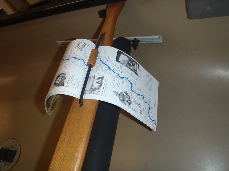
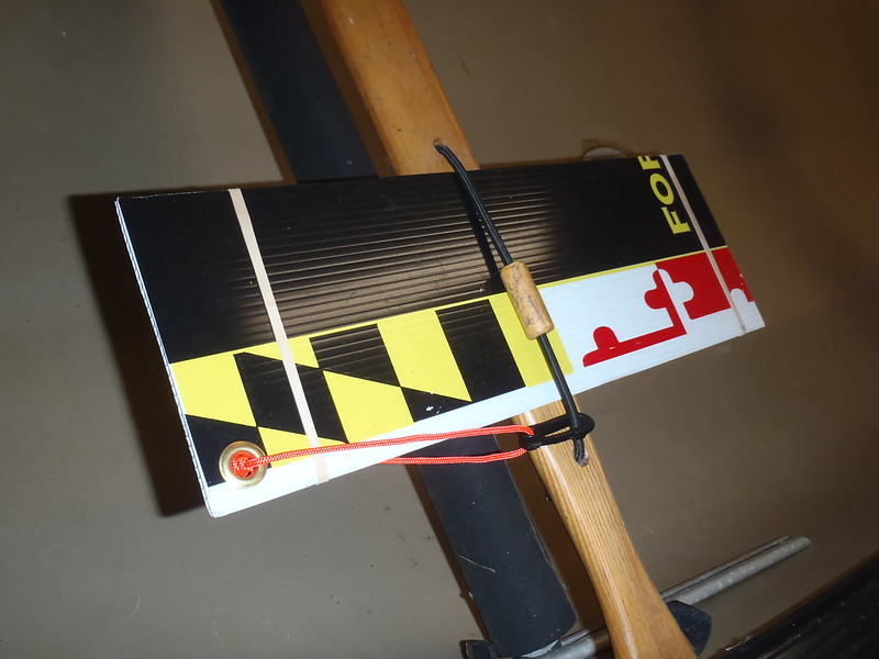
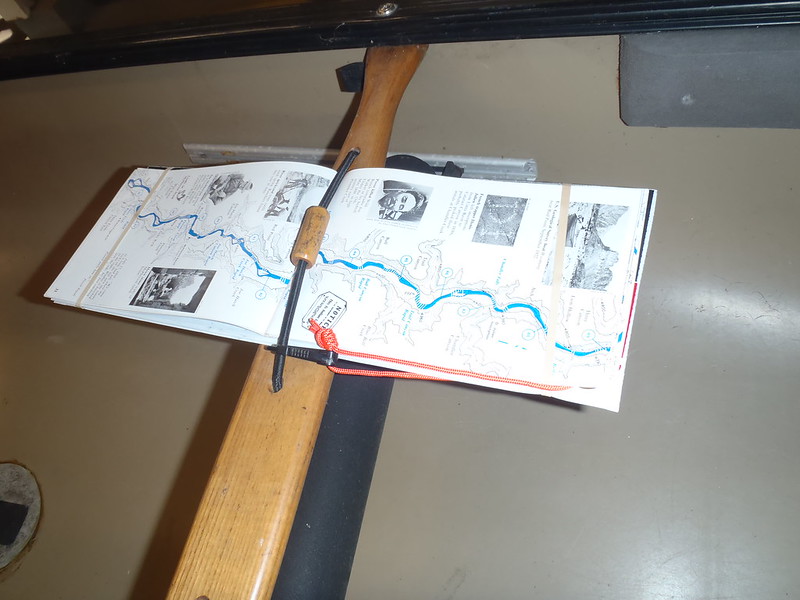
More annoying, because Belknap’s are long and skinny (17” long x 5 ½” wide when open), they are hard to keep readably flat. And unflappable in up-canyon winds.

PC171440 by Mike McCrea, on Flickr

The solution was cheap and easy, a piece of 17 x 5 ½ Coroplast cut from an old campaign yard sign, with a couple rubber bands to hold the map in place flat and unflappy.

PC171444 by Mike McCrea, on Flickr

PC171443 by Mike McCrea, on Flickr

Easy enough to flip to the next pages tucked under the rubber bands. I added a grommet, line and clip for security.

On western rivers I usually take (at least) two sets of maps or map books; Belknaps for easy viewing, printed/laminated topo maps for side details and, when available, a River Guidebook with maps and side hike, water source, ruins, artifacts and more prose history.

I’m a map head, and a reader. That printed stuff can keep me occupied in camp for hours. Other than the Belknaps I have not seen a guidebook for Desolation/Grey. The Kelsey book River Guide to Canyonlands and Vicinity starts at the town of Green River.
 
Dan, I noticed this in one of the reviews for the Belknaps map:

“Belknap's guidebooks are thick on everything but the maps. So if your looking for every bit of info about the river and could care less about a great map then this is good. I like a large, easy to read, topo map in my guidebook. I don't need it for a geology lesson, or another book telling me what animals I will see. The biggest drawback is that there is no information about how to run a rapid. RiverMaps is great too in this area.”

RiverMaps Green River in Desolation & Gray Canyons Guide Book (available from NRS)


https://www.nrs.com/product/66201.02/rivermaps-green-river-in-desolation-gray-canyons-guide-book

More info on the rapids besides some squiggly lines across the river would be helpful.
 
Mike,
Thanks for the good info. I will see if I pull the permit and then figure which boat to go with. I may end up lining / portaging on most of the bigger rapids if I bring the OT Pack. The flows should be lower in early September.
 
I will see if I pull the permit and then figure which boat to go with. I may end up lining / portaging on most of the bigger rapids if I bring the OT Pack. The flows should be lower in early September.

I like the idea that the RiverMaps book has information on campsites, the best of which on canyon rivers may be back some inauspicious “woulda-passed-right-by” side canyon opening. And the info on rapids. Especially info on rapids. The squiggly line across the river on the Belknaps isn’t much help in that regard.

Looking through this link on American Whitewater, reading the descriptions of the rapids (at both high and low water, some are harder at low water), and reading mentions elsewhere about the inaccessibility of some banks for lining or portaging due to ledges, willow overgrowth and etc, I’d want a bigger boat than the Pack.

https://www.americanwhitewater.org/content/River/detail/id/1854/

I enjoyed my Pack, but I am not a lightweight guy, nor a lightweight packer, and wasn’t running that canoe with a tripping gear load through Class II or III+.

OK, some minor class II’s when I was younger, weighed less and packed lighter.
 
Mike, I think you are right. If I pull the permit, I may need an inflatable kayak instead. The pack even with bow and stern air bags might not be the right boat.

I'm also going to put in for the Smith in Montana. I know that will be fine with the Pack.
 
The Green has a lot of class III rapids and the longest shuttle around except for maybe the Owyhee River in Idaho.
It is most suitable in a raft, drift boat or inflatable kayak.
I did a trip on the lower Green that was very enjoyable in canoes.
 
Back
Top