Maintaining canoe routes in my area of Northern Ontario is a non-stop job. Blowdown events, forest fires and logging keep route maintenance at a pretty high level.
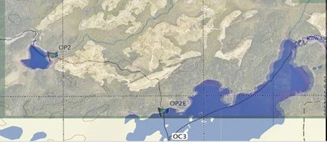
I had planned an 8 day trip for the school club this year starting at Onaman Lake and returning to Geraldton, a total of about 150 kilometres. One of my buddies who had been ice fishing at Onaman told me to check with the Ministry of Natural Resources because he had seen a lot of cutting going on in the area. I contacted the MNR, and sure enough, the major 3 kilometre portage that connected Onaman Lake to Fullerton had been cut. I superimposed my GPS track from 2013 over the Sat image the Ministry sent me, and it looked grim.
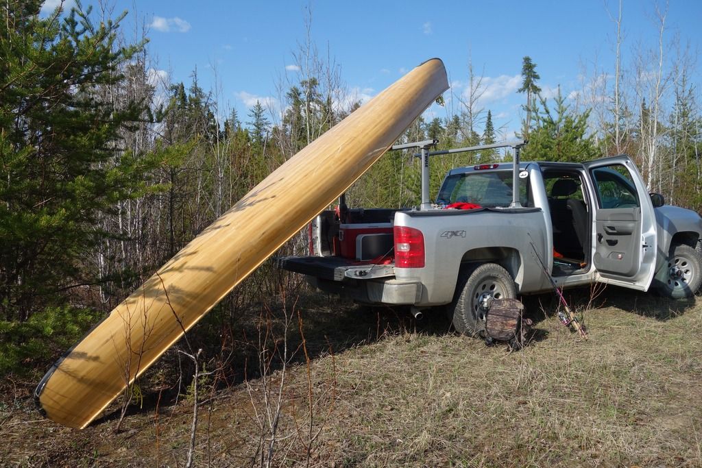
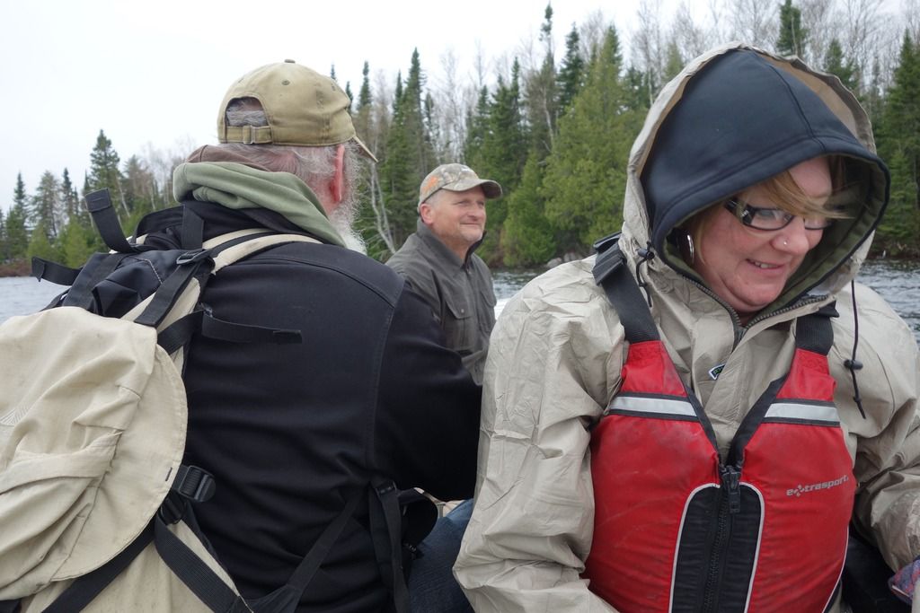
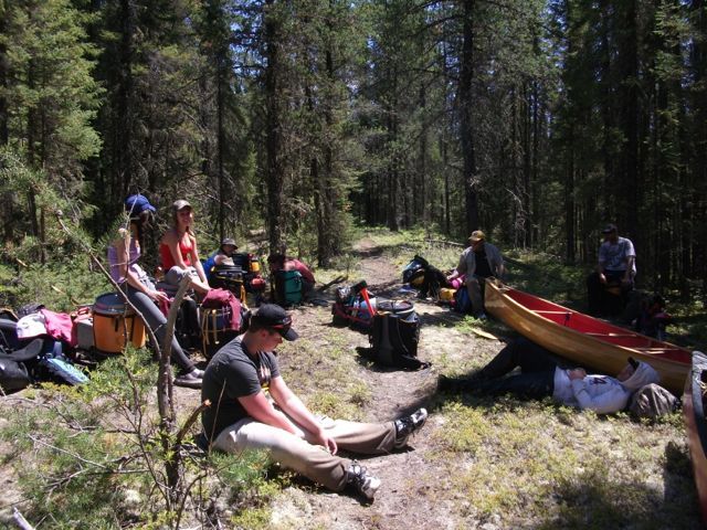
My buddy Chainsaw Rob and I decided to go in on the Victoria day long weekend to see if the port was still viable. My wife Irene and I were going in by canoe and Rob and our other buddy Dan were going in a small boat. We left at 4:30 on Friday drove through a series of progressively deteriorating logging roads until we reached a trail beside the Kowkash River. We were packed heavy for comfort and had the 20 foot canoe.
It took a half hour to lug everything down to the water and we were paddling by 6:35. Rob and Dan had come in during the afternoon and were already at camp.
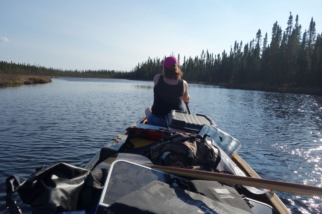
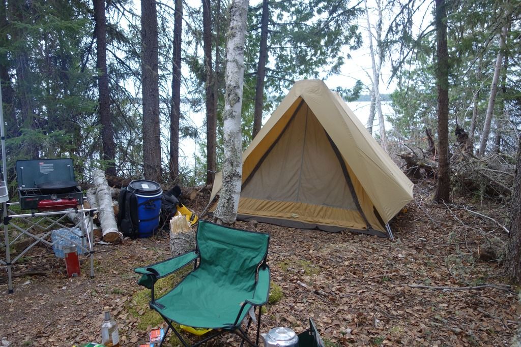
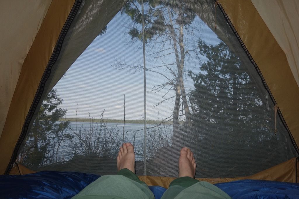
We had a leisurely paddle to Fullerton Lake, covering the ten k in about two hours. Got to camp at around 8:45 and started setting up. Brought an old Eureka Outfitter from the early 80’s out for this trip, still a good tent.
I also brought both of my new paddles. Just finished the skinny otter tail style one last week, painted it after something I saw on the inter-webs. I am somewhat loath to admit it, but I actually enjoyed paddling with that skinny little thing.
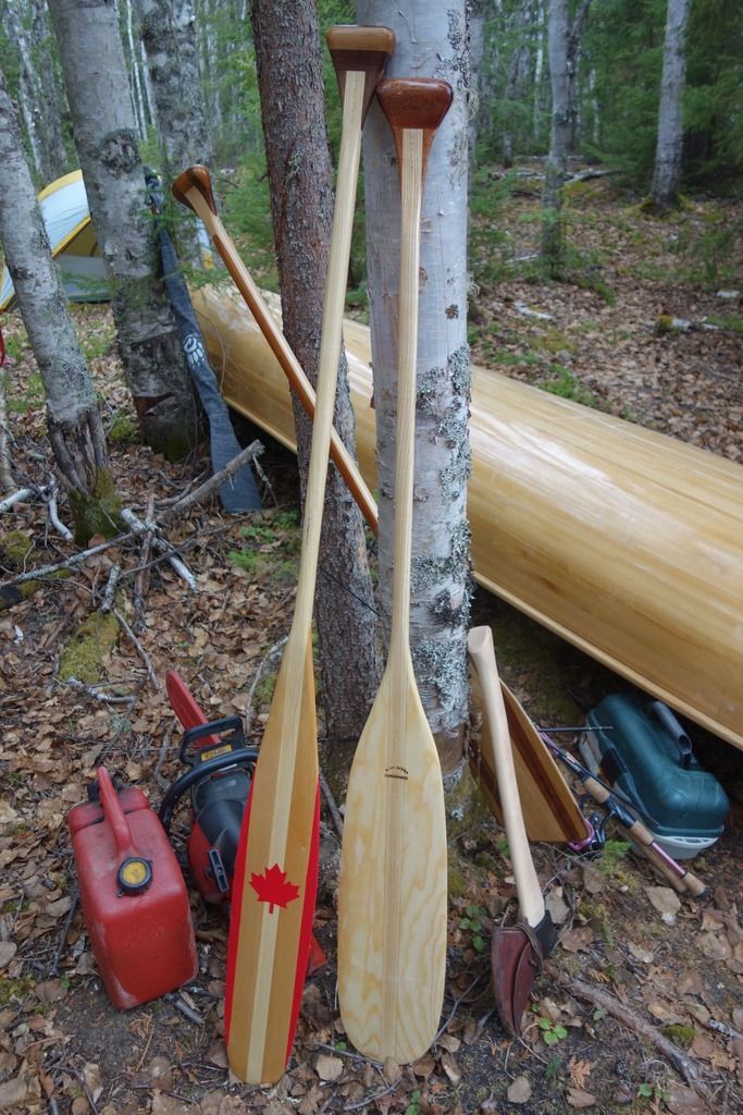
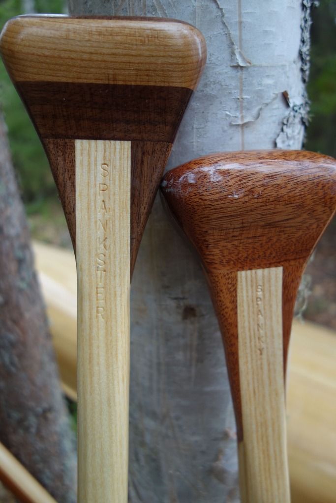
The new paddles are related.
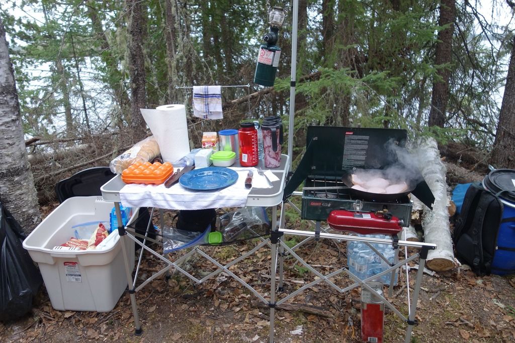
Irene bought me this suitcase style cooking station for christmas last year. It’s really quite cool, not very heavy at all, and folds out into a huge working area. Never thought I would like things like that, but the older I get, the more I enjoy creature comforts.
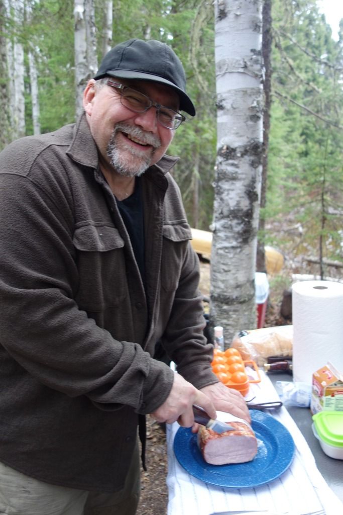
If you look closely, you’ll see why I’m smiling. I’m slicing up a big chunk of Canadian bacon with the Ripster!
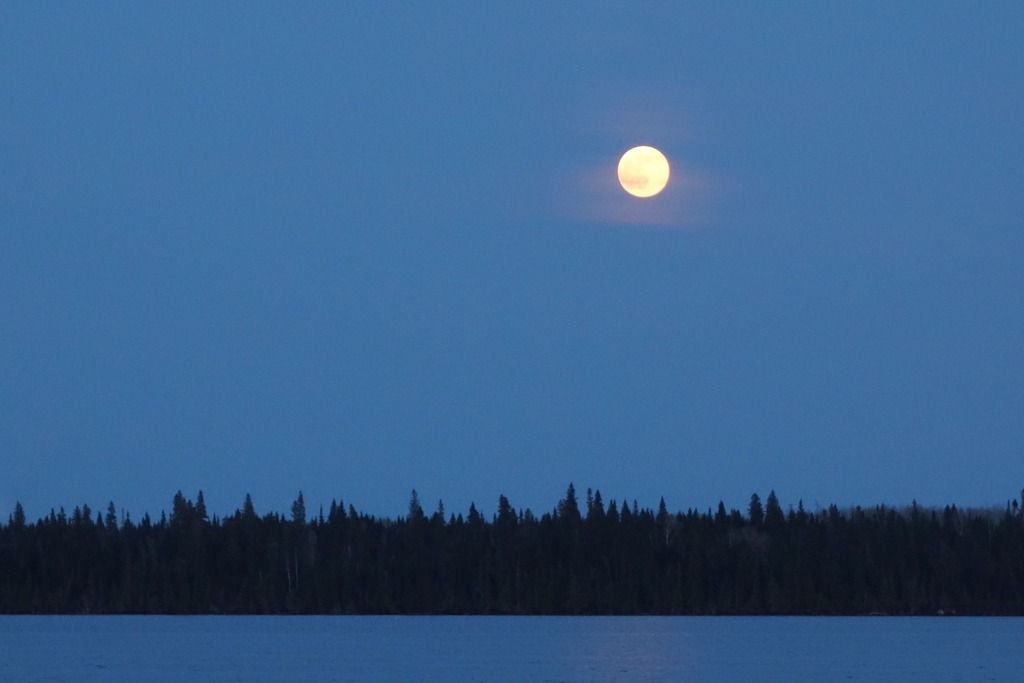
We had a great night, drinking Bud Lights under a full moon, and shooting the old Taurus feces. No fire though, as there is still a fire ban on across most of Northern Ontario.
In the morning, we piled into Rob’'s 14 foot boat with an 8 horse, and boated the short distance over to the portage.
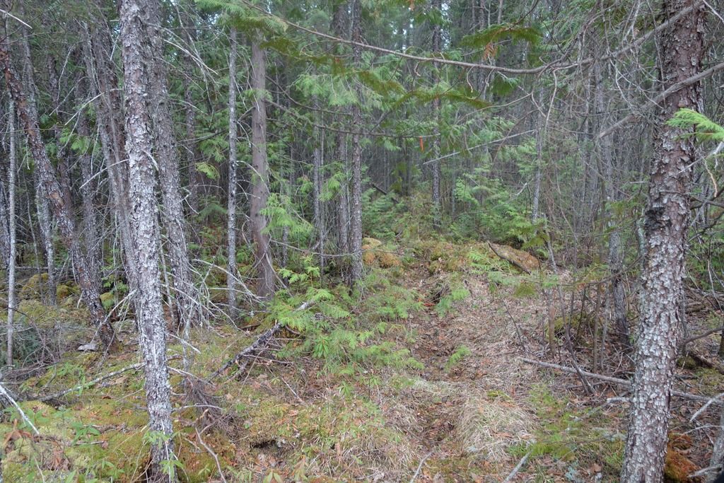
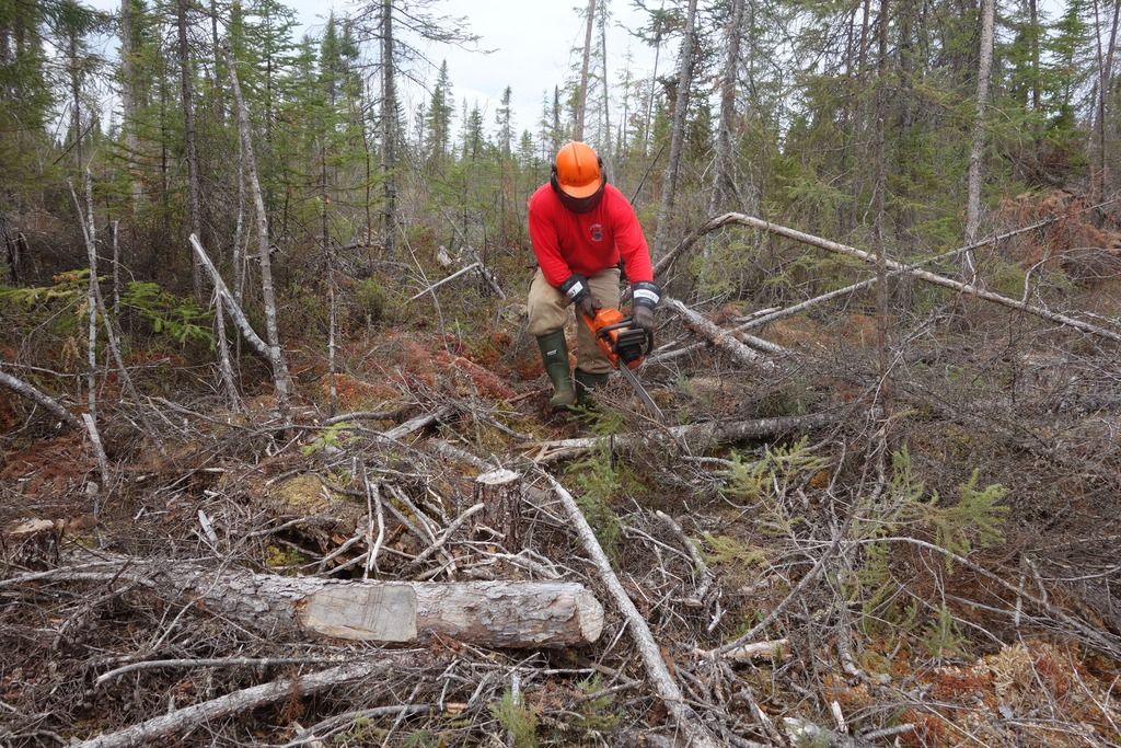
The first 660 meters of this three kilometre port is still intact. It is a fairly awful affair, full of mud holes, a typical northern Ontario cedar swamp port.
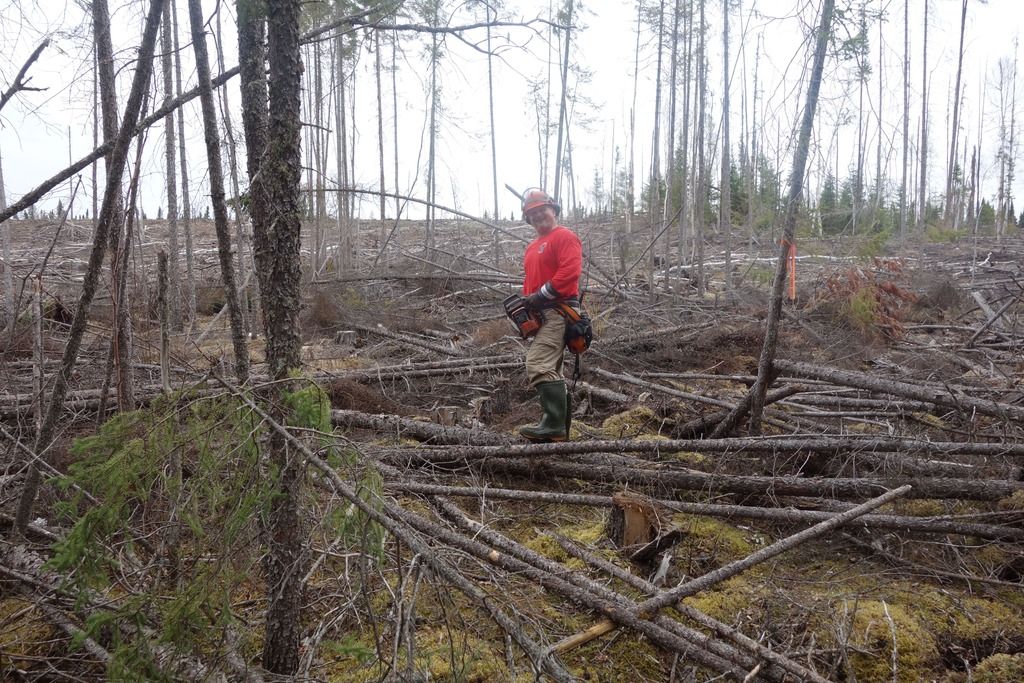
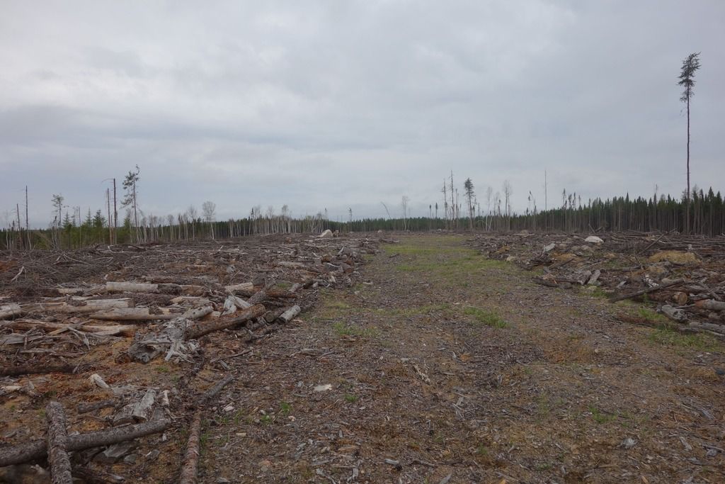
When we got to the end of this stage, the sight that greeted us was quite disheartening.
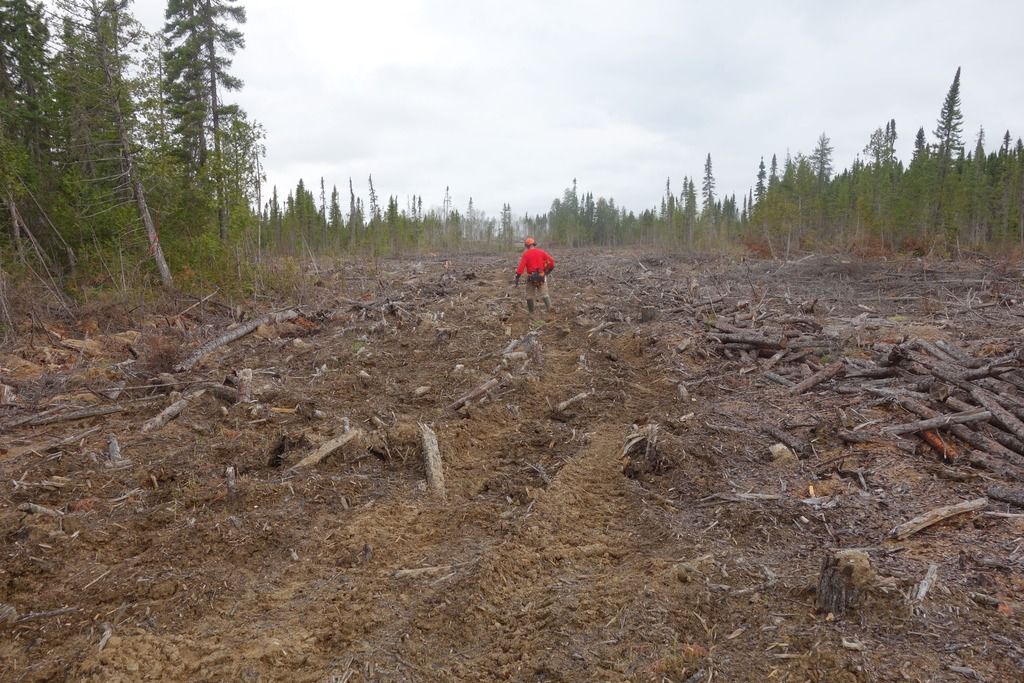
To add some scale.
We clambered through the cutover and arrived at the top. The first view was not bad. If there was a major road system like this to the other end, we could probably make something of the cut over approach.
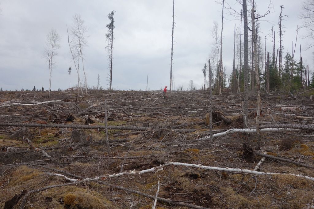
However, it soon degraded into the typical skid way, full of stumps and stickers, just waiting for someone to fall and be impaled.
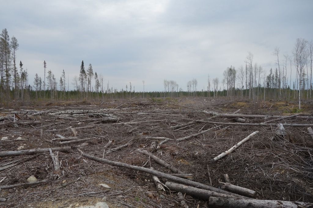
This is a pretty typical view of a cutover. The amount of wood that is wasted is fairly shocking.
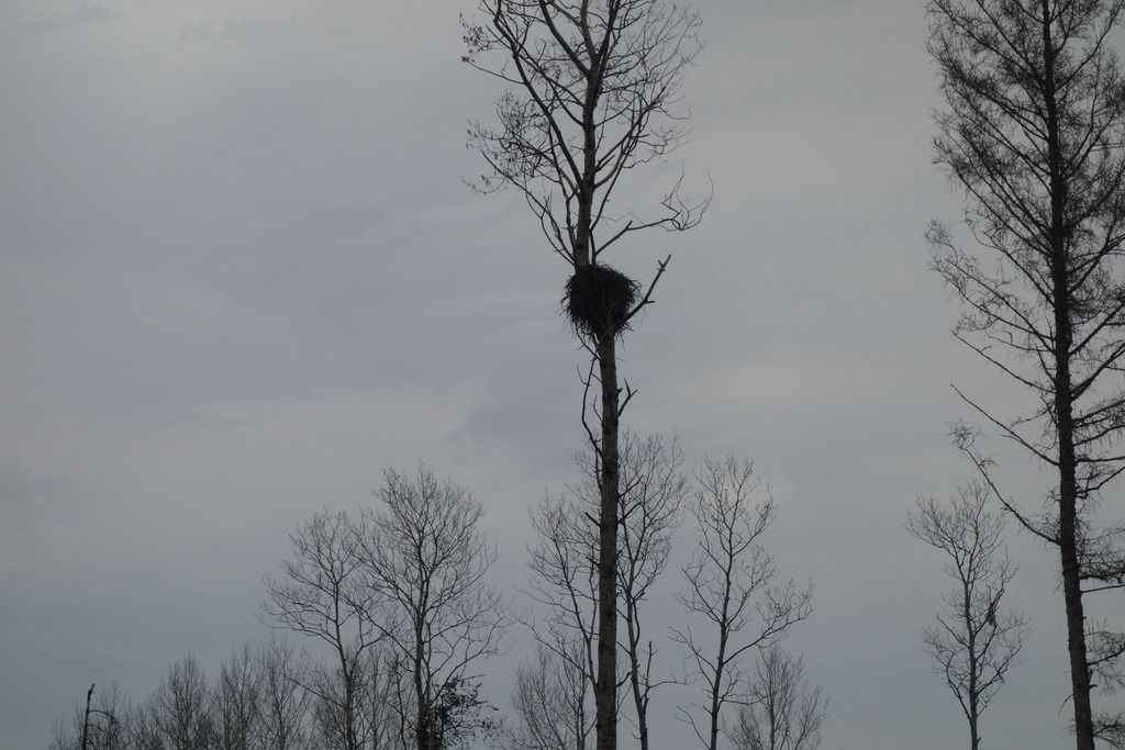
There was a big raptor nest in the middle of the cutover. Hopefully, it is a new one, as logging operations are supposed to give a one mile buffer on all raptor nests.
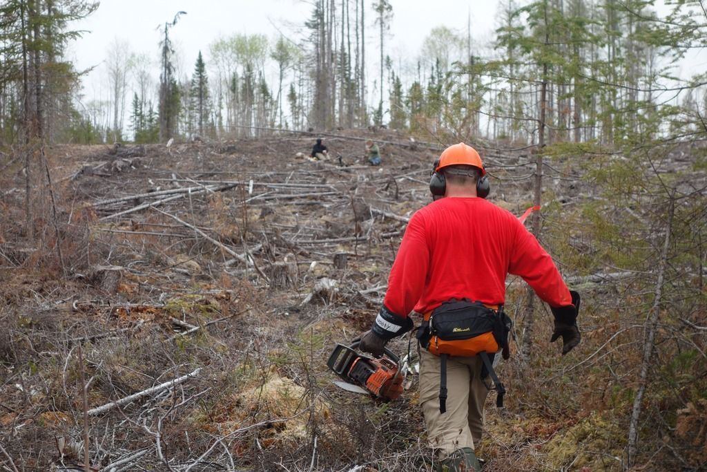
We located the other end of the port and tried to hack some kind of trail through the cut.
This is us walking back up to the skid way from the other end of the port.
On the three kilometre walk back to the boat, I decided that we would probably never use this port again. Sections of it were full of stumps and sharp hunks of wood that will continue to surface for years. They are an impalement accident waiting to happen. As well, there is absolutely no tree cover for two K, so taking a bunch of kids over on a hot day would probably result in heat stroke. The port was always challenging, but it was never dangerous.
We got back to camp at around two in the afternoon, and I decided to recline and watch some nature TV.
We all did some fishing afterwards, but Fullerton Lake, although big and beautiful, seems to be only a pike lake. Everyone was fairy tired tonight, so by 11:00 PM we were crashed out, watching the moon rise over us.
I Looks like the Outers Club will be reverting to plan B again. I’m going to drive up the Ogoki road tomorrow to see if a bus can get to the Kapikotongwa Bridge.
Edited to add a shot of this same port from 2013 when we went through. This high sandy ridge was a pounded down caribou trail. Now it's just pounded down. This would have been right around the shot of the skidway with all the stumps in it.
I had planned an 8 day trip for the school club this year starting at Onaman Lake and returning to Geraldton, a total of about 150 kilometres. One of my buddies who had been ice fishing at Onaman told me to check with the Ministry of Natural Resources because he had seen a lot of cutting going on in the area. I contacted the MNR, and sure enough, the major 3 kilometre portage that connected Onaman Lake to Fullerton had been cut. I superimposed my GPS track from 2013 over the Sat image the Ministry sent me, and it looked grim.

My buddy Chainsaw Rob and I decided to go in on the Victoria day long weekend to see if the port was still viable. My wife Irene and I were going in by canoe and Rob and our other buddy Dan were going in a small boat. We left at 4:30 on Friday drove through a series of progressively deteriorating logging roads until we reached a trail beside the Kowkash River. We were packed heavy for comfort and had the 20 foot canoe.

It took a half hour to lug everything down to the water and we were paddling by 6:35. Rob and Dan had come in during the afternoon and were already at camp.

We had a leisurely paddle to Fullerton Lake, covering the ten k in about two hours. Got to camp at around 8:45 and started setting up. Brought an old Eureka Outfitter from the early 80’s out for this trip, still a good tent.

I also brought both of my new paddles. Just finished the skinny otter tail style one last week, painted it after something I saw on the inter-webs. I am somewhat loath to admit it, but I actually enjoyed paddling with that skinny little thing.

The new paddles are related.

Irene bought me this suitcase style cooking station for christmas last year. It’s really quite cool, not very heavy at all, and folds out into a huge working area. Never thought I would like things like that, but the older I get, the more I enjoy creature comforts.

If you look closely, you’ll see why I’m smiling. I’m slicing up a big chunk of Canadian bacon with the Ripster!

We had a great night, drinking Bud Lights under a full moon, and shooting the old Taurus feces. No fire though, as there is still a fire ban on across most of Northern Ontario.
In the morning, we piled into Rob’'s 14 foot boat with an 8 horse, and boated the short distance over to the portage.

The first 660 meters of this three kilometre port is still intact. It is a fairly awful affair, full of mud holes, a typical northern Ontario cedar swamp port.

When we got to the end of this stage, the sight that greeted us was quite disheartening.

To add some scale.

We clambered through the cutover and arrived at the top. The first view was not bad. If there was a major road system like this to the other end, we could probably make something of the cut over approach.

However, it soon degraded into the typical skid way, full of stumps and stickers, just waiting for someone to fall and be impaled.

This is a pretty typical view of a cutover. The amount of wood that is wasted is fairly shocking.

There was a big raptor nest in the middle of the cutover. Hopefully, it is a new one, as logging operations are supposed to give a one mile buffer on all raptor nests.

We located the other end of the port and tried to hack some kind of trail through the cut.

This is us walking back up to the skid way from the other end of the port.

On the three kilometre walk back to the boat, I decided that we would probably never use this port again. Sections of it were full of stumps and sharp hunks of wood that will continue to surface for years. They are an impalement accident waiting to happen. As well, there is absolutely no tree cover for two K, so taking a bunch of kids over on a hot day would probably result in heat stroke. The port was always challenging, but it was never dangerous.
We got back to camp at around two in the afternoon, and I decided to recline and watch some nature TV.

We all did some fishing afterwards, but Fullerton Lake, although big and beautiful, seems to be only a pike lake. Everyone was fairy tired tonight, so by 11:00 PM we were crashed out, watching the moon rise over us.

I Looks like the Outers Club will be reverting to plan B again. I’m going to drive up the Ogoki road tomorrow to see if a bus can get to the Kapikotongwa Bridge.
Edited to add a shot of this same port from 2013 when we went through. This high sandy ridge was a pounded down caribou trail. Now it's just pounded down. This would have been right around the shot of the skidway with all the stumps in it.

Last edited:
